.png)

Resources | Ice Cover on Lake Huron
Ice Cover on Lake Huron
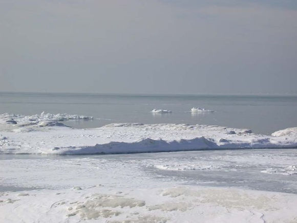
Like water levels on the Great Lakes, Ice Cover also fluctuates from year to year. Annual ice cover on Lake Huron affects much more than just how many days we can go ice fishing or skating. Years with heavy ice coverage inevitably affect the nautical shipping industry, precipitation and evaporation trends for spring, as well as lake levels and water quality for that year's summer months.
As climate change continues to alter North American atmospheric conditions, we can expect to see more variation in ice cover on Lake Huron. Below is a graph from the National Oceanic and Atmospheric Administration (NOAA) illustrating ice coverage trends on the Great Lakes (not Lake Huron specific) over the past 50 years.
If you want to see real-time ice coverage information on Lake Huron, you can find it here.

Lake Huron and Our Snowy Winters

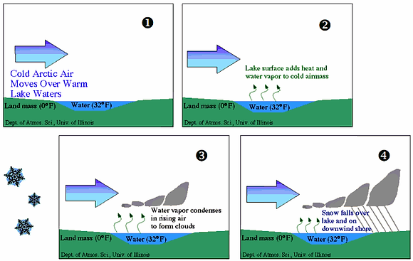
Lake-generated snow squalls form when cold air, passing for long distances over the relatively warm waters of a large lake, picks up moisture and heat and is then forced to drop the moisture in the form of snow upon reaching the downwind shore.
Lake-effect snows are common over the eastern shores of Lake Huron and Georgian Bay because these large bodies of water can hold their summer heat well into the winter, rarely freeze over and provide the long fetch (distance of water that the wind blows across) which allows the air to gain the heat and moisture required to fuel the snow squalls.
There are some key ingredients that you need to produce lake effect snow. The first is a relatively warm body of water (e.g. Great Lake). The second ingredient is a source of cold air. In the Great Lakes Region, that source comes from the high latitudes of North America where dry arctic air masses often "spill southward" over those warm bodies of water. Heat and moisture from the warm lakes rises into the "modified" arctic air where it then cools and condenses into snow clouds.
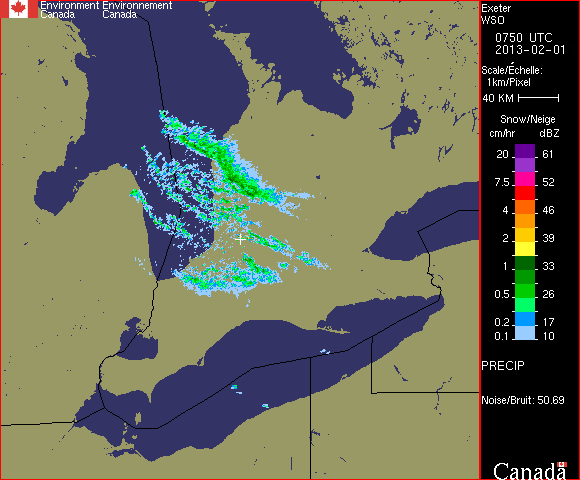
Historical Weather (Exeter, ON): February 1, 2013
The prevailing wind direction determines where the snow will occur. On Lake Huron, air masses coming from the northwest will have a much larger fetch to travel over, and so have more of an opportunity to pick up moisture. Snow squalls from the northwest usually provide the most intense squall systems and can penetrate deeply over the land. A snow squall's maximum penetration inland will generally be greatest during late autumn/early winter and shortest during the late winter.
Squalls can be costly business along Lake Huron with high expenditures for snow removal, frequent hazardous driving conditions, and in general, adding to the rigours of winter weather besetting residents in this region. Climate change projections for the Great Lakes suggest that snow squalls may intensify, due to a higher temperature regime and more open, ice-free winters.
Identifying the conditions that are favourable for snow to develop over the lake is the key to forecasting lake effect snow. The components include:
-
Unfrozen lake
-
Air above the lake (850 mb) at least 5C degrees cooler than surface water temperature
-
Enough moisture (water vapour) to support snow
-
Enough wind to convey the snow onto land
-
Direction of the wind will imply where the snow will make landfall